In this final installment of our online flood portal series, we get to the nitty gritty of how we can actually build a system that is easy to use and understand.
Firstly, a flood portal can mean a number of things to different end users, with capability of systems we have rolled out including:
- access to design and historic flood data
- access to flood certificates or property flood reports
- access to current and forecast flood information
The first step in establishing a flood portal is to determine what information you would like to make available.
It is likely that this information will be a subset of your full flooding data, curated to ensure that the end user is able to easily access what they need, without excessive "dataset noise".
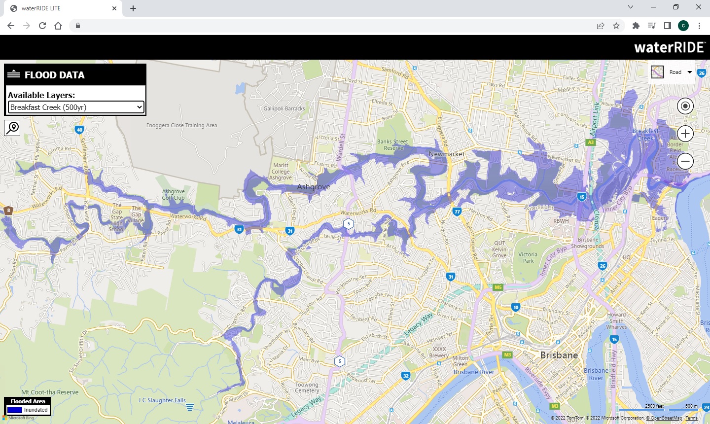
Data views in waterRIDE LITE link directly to standard views in a waterRIDE project, carrying through layer thematic settings, colours and parameters for interrogation.
waterRIDE CLOUD vs waterRIDE LITE
Tthe starting point becomes deciding which views in your waterRIDE projects you would like to share, and whether you would like users to be able to click on the waterRIDE LITE map and interrogate any underlying hydraulic parameter value(s) (and which parameters you'd like them to access).
If you have an automated flood certificates system you'd like to take online, then it's a simple process of ensuring your certificates project is fully functioning as all requests for a certificate are carried out on the server using your project (via the waterRIDE API).
This means that any changes to your certificates project are automatically live the moment you save your certificates project, including any new flood information, template changes or layer display settings.
The final steps are to configure your API key for any base layers such as BING, Google, Open Street Maps, or WMS/XYZ image servers, and then the structure of your waterRIDE LITE dropdown list (if needed) to allow users to navigate to their layer of interest.
The above datasets and configuration are then uploaded to our servers and the waterRIDE API linked to the waterRIDE CLOUD server that your data resides on to enable live interrogation/requests from waterRIDE LITE.
A simple link is provided that can be included/integrated with your website (example: Lismore City Council).
The beauty of the waterRIDE LITE platform is its simplicity, ability to link to the same datasets that the data owners are using, and its ability to operate on any device (phone, tablet, laptop, desktop), without any software installation.
In all, a very straightforward process. In fact, if you've already got your waterRIDE projects setup, you're probably looking at having your portal up and running in 24hrs!
Recently, we had a customer (an engineering consultant) comment on how easily they were able to access the datasets they needed on behalf of a developer from the Local Council using waterRIDE CLOUD.
Whilst this consultant had not used waterRIDE CLOUD previously, they were an active user of waterRIDE Classic and their feedback was that it was "just like it was all on my computer".
Council has all of their flooding information stored on waterRIDE CLOUD and uses a structured master project to provide quick access to catchment-based waterRIDE projects internally.
In this instance, Council was able to send a link to the consultants email address, providing access to the specific project covering the area of interest for a limited period of time (48hrs in this case) using a Viewer (read only) license.
When the consultant logged on, they utilised one of Councils Viewer licenses (ie they did not need a license themselves) and the specified project automatically opened.
From there, the consultant was able to interrogate and analyse the full hydraulic datasets, with Council-defined permissions on the ability to extract and save information.
This highlights the benefit of centralised datasets, and the seamless ability to share access to information rather than the information itself using next-gen cloud platforms.
It certainly beats the alternative of copying to a hard drive, posting, and waiting...
As our October sessions draw to a close, we have updated next years group training schedule on the website.
Continuing with the online, half-day sessions over a two week window, the training program provides interactive learning on a wide range of waterRIDE's core and advanced functionality.
Bookings are open for next years sessions, online.